 |
| Hafez Assad "fishing" from the Golan Heights above the Sea of Galilee |
On our way back to Ein Gev, I'd called Betty to see if she and Doobie would come up to have a glass of wine since we were so close, and we were getting back at a reasonable time. What a miracle we did this, because, although we didn't know it at the time, it would be our last in-person meeting. We were supposed to meet again in Jerusalem the night before my departure, but it didn't happen. It was all Shimon Peres' fault, and I'll tell you about it when we get to that point of the story. We were able to spend at least an hour or two talking, parting with hugs (and no tears).
When Betty and I first seriously started planning my trip, she'd asked me if I wanted to go to Beit She'an. At the time I didn't even know what it was. She wanted to hire a friend of hers who is a licensed tour guide to take me. Turned out that wasn't necessary since it was included in the Road Scholar adventure.
What is Beit She'an, you ask?
It's a set of ruins about 45 minutes from the kibbutz where Betty and Doobie live. Excavations there indicate that settlement may date back to the Late Neolithic or the Early Chalcolithic age, a timeline that defies imagining. The city has been occupied by the Egyptians, Romans, Greeks, Crusaders, Mamluks, Ottomans and more. You simply must read the explanation contained in the link above, because I can't begin to scratch the surface of what the city has seen.
The ruins themselves blew our minds. We thought they were massive, with areas of the "tel" (mountain) yet to be uncovered.
 |
| This was our first view of Beit She'an from the visitor center above. The "mountain" behind (the tel) contains ruins and artifacts yet to be uncovered. This does not begin to show the size of Beit She'an. |
 |
| This is the road ("cardo" that led north-south through the city. |
 |
| This was a portion of the caldarium, or baths. The floor would sit on these pillars, and water would be poured around them to heat the bath area. |
 |
| Columns along the Cardo which have been re-erected |
 |
| Detail of the capital, or top, of the column. |
 |
| A portion of the Decumanus (East-West Road), showing the earthquake's destruction. |
 |
| I'll bet you'll never guess what this is . . . |
 |
| Gila, our guide par-excellance, taught us everything, including how to use the latrine! I guess the Romans didn't believe in privacy. |
Here's yet another view of Beit She'an, as we rounded the walkway approaching our exit from the site.

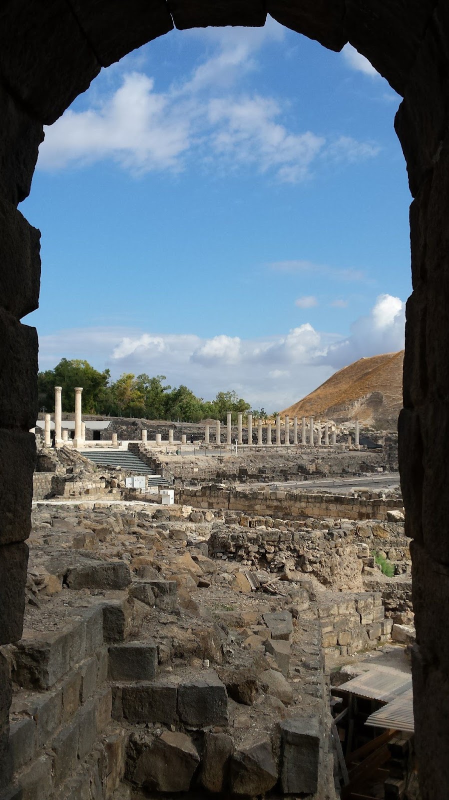 |
| Beit She'an through an arch |
The grounds of Beit She'an National Park are simply beautiful, with an area around the visitors center where families can sit in the shade of fig trees and grape arbors and relax as they contemplate the ancient past.

We had arrived at Beit She'an a few minutes before its scheduled opening, and we had to wait a bit for the caretaker to arrive and open it up. Gila had planned for an early morning because we had yet another adventure to undertake, and she wanted to tackle it as early as possible: our border crossing from Israel into Jordan.
No comments:
Post a Comment