As we left the crowded city, we passed open fields where tents were randomly pitched. Our guide, Zac, told us these were Bedouin camps, where Arab nomads live as they have lived for centuries with their goats and camels. We would see a number of these throughout the day as we traveled through the deserts of Jordan on our way to Petra.
Mt. Nebo is a hill a little less than 3,000 feet high and is also where tradition says Moses died and was buried. As with most Biblical sites, there is controversy and conjecture over this.
 |
| A monument to honor and memorialize Moses |
 |
| A sign points the way to the Promised Land. |
 |
| And this is the actual view. |
 |
| The "Brazen Serpent" statue as talked about in the book of Numbers, created by Giovanni Fantoni. |
 |
| Mosaic in the Byzantine Church on Mt Nebo |
 |
| This camel-hair tent shields the church excavation |
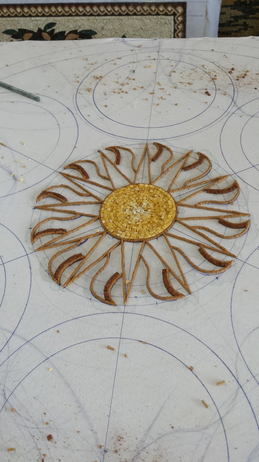 |
| The early stages of creation |
 |
| Approaching completion |

and one last magnificent piece:
 |
| A table-top with inlaid mother-of-pearl |
We'd had a full morning, and it was now lunchtime. Perish the thought that we should miss a meal!
Our lunch spot was once again unique; a lovely shaded outdoor patio at Haret Jdoudna.
 |
| This is the restaurant's entrance. |
 |
| Just inside the entrance resides the owner's vintage Mercedes |
 |
| These steps led to the restrooms upstairs and illustrate the beauty of the patio where we dined. |

 |
| Exterior of St George's Church |
 |
| Interior of St. George's |
This would be the longest drive we'd experienced to date, and we took advantage of the time to nap or catch up on emails with the bus's wifi or just gaze at the barren Jordanian desert.
The terrain turned more mountainous as we approached Petra, and the road twisted in hairpin turns as we neared the summit. Suddenly before us, perched on a cliff, was a magnificient Crusader castle:


This is known as Montreal Crusader Castle, and I found an interesting YouTube video describing it and showing some of its interior. Unfortunately we only got to view its exterior.
Speaking with Gila, she told me she'd sat where she had an excellent view of the very narrow road. "The wheels were right on the edge," she shook her head. "I thought we were awfully close."
Luckily my view wasn't that good.
Next stop: Petra, land of the Nabateans.
No comments:
Post a Comment